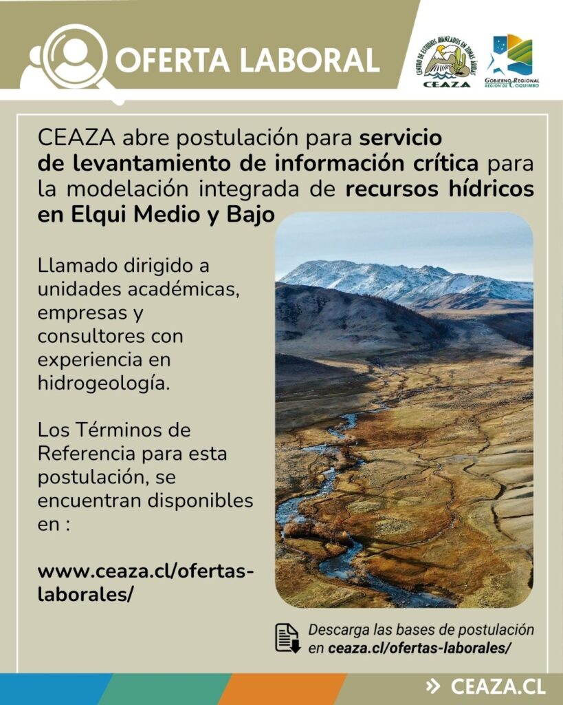
1 17 18 19 20 21 27

Twelve Years of Change in Coastal Upwelling along the Central-Northern Coast of Chile: Spatially Heterogeneous Responses to Climatic Variability.

Autores:

Aravena, G., Broitman, B., & Stenseth, N.

Resumen:

We use time-series analyses to characterize the effects of recent climate variability upon the local physical conditions at 11 study sites along the northern-central coast of Chile (29–34°S). Environmental indices show that the 1° Bakun upwelling index in this coastal region has fluctuated in time, starting from a stable period around the 1980's, peaking during the mid 90s, decreasing during the next ten years and increasing at a steep rate since 2010. Upwelling intensity decreased with increasing latitude, showing also a negative correlation with climate patterns (El Niño3 sea surface temperature-SST anomalies and the Multivariate El Niño Index). We hypothesize that the impacts of climate variability on upwelling events seem to be spatially heterogeneous along the region. Non-sheltered locations and, particularly, sites on prominent headlands show an immediate (lag = 0) and negative correlation between local SST, upwelling events and wind stress. We suggest that near-shore thermal conditions are closely coupled to large-scale forcing of upwelling variability and that this influence is modulated through local topographic factors.

Año: 2014

Palabras claves: Chile (country), Surface temperature, Oceanography, El Niño-Southern Oscillation, Summer, Latitude, Seasons, Ocean temperature.

Referencia APA: Aravena, G., Broitman, B., & Stenseth, N. (2014). Twelve Years of Change in Coastal Upwelling along the Central-Northern Coast of Chile: Spatially Heterogeneous Responses to Climatic Variability. Plos ONE, 9(2), e90276.

Hongos endófitos antárticos como herramienta para la reintroducción de especies nativas en zonas áridas.

Autores:

Fardella, C., Oses, R., Torres-Díaz, C., & Molina-Montenegro, M.

Resumen:

Ecological restoration is the deliberate action that speeds recovery from a degraded system by direct or indirect human intervention. Xerophytic formations are among the most degraded ecosystems where low water availability makes reintroduction plans unsuccessful and extremely expensive. Roots inoculation with endophytic fungi has been reported as a successful strategy to maintain or improve the ecophysiological performance and survival in different species of shrubs and trees. In harsh environments, endophytes have been shown to provide benefits in terms of survival and growth for their associated vegetation. In this study, we showed that inoculation with endophytes isolated from plants growing in Antarctica improve survival and water use efficiency for irrigation on native species of xerophytic formations: Flourensia thurifera, Senna cumingii and Puya berteroniana. Overall, the presence of endophytes improved survival of all native species. Furthermore, the presence of endophytes improved water use efficiency for irrigation, reaching higher percentages of survival in plants with a reduction in the added water. The application of Antarctic endophytes could be considered a successful strategy for future projects and reintroduction programs in arid and semi-arid zones of Chile.

Año: 2014

Palabras claves: Endophytes, water use efficiency, xerophytic formations, restoration.

Referencia APA: Fardella, C., Oses, R., Torres-Díaz, C., & Molina-Montenegro, M. (2014). Hongos endófitos antárticos como herramienta para la reintroducción de especies nativas en zonas áridas. Bosque (Valdivia), 35(2), 235-239. http://dx.doi.org/10.4067/s0717-92002014000200011

Identifying appropriate spatial scales for marine conservation and management using a larval dispersal model: The case of Concholepas concholepas (loco) in Chile.

Autores:

Garavelli, L., Kaplan, D., Colas, F., Stotz, W., Yannicelli, B., & Lett, C.

Resumen:

Along the coast of Chile, fisheries targeting the marine gastropod Concholepas concholepas, commonly named “loco”, were highly valuable until the end of the 80s when catches declined significantly. Since the late 90s, a management plan based on territorial-user-rights areas has been implemented, with limited effect on stock recovery. More effective loco conservation and management is impeded by lack of information regarding connectivity via larval dispersal between these individually-managed areas. To develop a regional view of loco connectivity, we integrate loco life history information into a biophysical, individual-based larval dispersal model. This model is used to evaluate scales of loco connectivity and seasonality in connectivity patterns, as well as to partition the coast into largely disconnected subpopulations using a recently developed connectivity-matrix clustering algorithm. We find mean dispersal distances ranging from 170 to 220 km depending on release depth of larvae and planktonic larval duration. Settlement success levels depend quantitatively on the physical and biological processes included in the model, but connectivity patterns remain qualitatively similar. Model estimates of settlement success peak for larval release dates in late austral autumn, consistent with field results and with favorable conditions for larval coastal retention due to weak upwelling during austral autumn. Despite the relatively homogeneous Chilean coastline, distinct subpopulations with minimal connectivity between them are readily identifiable. Barriers to connectivity that are robust to changes in model configuration exist at 23°S and 29°S latitudes. These zones are all associated with important headlands and embayments of the Chilean coast.

Año: 2014

Palabras claves:

Referencia APA: Garavelli, L., Kaplan, D., Colas, F., Stotz, W., Yannicelli, B., & Lett, C. (2014). Identifying appropriate spatial scales for marine conservation and management using a larval dispersal model: The case of Concholepas concholepas (loco) in Chile. Progress In Oceanography, 124, 42-53.

Antarctic macrolichen modifies microclimate and facilitates vascular plants in the maritime Antarctica – a reply to Casanova-Katny et al.

Autores:

Molina-Montenegro, M., Torres-Díaz, C., & Gianoli, E.

Resumen:

In a current article in the Journal of Vegetation Science, Casanova-Katny et al. addressed a comment about an article by Molina-Montenegro et al., which demonstrated the climate modification induced by the macrolichen Usnea antarctica and its role as facilitator. They provided useful corrections concerning species identification and pointed out several issues that, in their view, weakened our study. They indicated that the role of U. antarctica as a facilitative species in the maritime Antarctica is merely philosophical and has no ecological relevance. In this commentary, we argue why these critiques are unsubstantial, and provide evidence that the macrolichen can modify the microclimate, ameliorating the harsh conditions prevailing in Antarctica, establishing positive interactions and eventually facilitating vascular species. Thus, the macrolichen U. antarctica would act as a ‘nurse species’, playing a key role in structuring the maritime Antarctic plant community.

Año: 2014

Palabras claves: Antarctica; Deschampsia Antarctica; Facilitation; Nurse effect; Positive interactions.

Referencia APA: Molina-Montenegro, M., Torres-Díaz, C., & Gianoli, E. (2014). Antarctic macrolichen modifies microclimate and facilitates vascular plants in the maritime Antarctica - a reply to Casanova-Katny et al. (2014). J Veg Sci, 25(2), 606-608.

Spatial variability in community composition on a granite breakwater versus natural rocky shores: Lack of microhabitats suppresses intertidal biodiversity.

Autores:

Aguilera, M., Broitman, B., & Thiel, M.

Resumen:

Strong differences have been observed between the assemblages on artificial reefs and on natural hard-bottom habitats worldwide, but little is known about the mechanisms that cause contrasting biodiversity patterns. We examined the influence of spatial attributes in relation to both biogenic and topographic microhabitats, in the distribution and composition of intertidal species on both artificial and natural reefs. We found higher small-scale spatial heterogeneity on the natural reef compared with the study breakwater. Species richness and diversity were associated with a higher availability of crevices, rock pools and mussels in natural habitats. Spatial distribution of certain grazers corresponded well with the spatial structure of microhabitats. In contrast, the lack of microhabitats on the breakwater resulted in the absence of several grazers reflected in lower species richness. Biogenic and topographic microhabitats can have interactive effects providing niche opportunities for multiple species, explaining differences in species diversity between artificial versus natural reefs.

Año: 2014

Palabras claves: Artificial reefs; Biodiversity; Breakwater; Grazers; Spatial heterogeneity; Microhabitats.

Referencia APA: Aguilera, M., Broitman, B., & Thiel, M. (2014). Spatial variability in community composition on a granite breakwater versus natural rocky shores: Lack of microhabitats suppresses intertidal biodiversity. Marine Pollution Bulletin, 87(1-2), 257-268.

Internal structure and composition of a rock glacier in the Andes (upper Choapa valley, Chile) using borehole information and ground-penetrating radar.

Autores:

Monnier, S. & Kinnard, C.

Resumen:

This study uses boreholes, ground temperature monitoring and ground-penetrating radar (GPR) in order to understand the internal structure and composition of a rock glacier in the upper Choapa valley, northern Chile. The rock glacier is a small valley-side feature, 200 m long and ranging between 3710 and 3780 m a.s.l. Two boreholes were drilled down to depths of 20 and 25 m, respectively, using the diamond drillhole technique. An ice–rock mixture was encountered in the boreholes, with heterogeneous ice content averaging 15–30%. Data from common-midpoint (CMP) and constant-offset (CO) GPR surveys acquired, respectively, near the boreholes and across the whole rock glacier were processed to highlight the internal stratigraphy and variations in the radar-wave velocity. The GPR profiles depict a rock glacier constituted of stacked and generally concordant layers, with a thickness ranging from 10 m in its upper part to ∼30 m towards its terminus. The CMP analysis highlights radar-wave velocities of 0.13–0.16 m ns–1 in the first 20 m of the structure. Larger vertical and lateral velocity variations are highlighted from CO data, reflecting the heterogeneous composition of the rock glacier and the likely presence of unfrozen water in the structure. Given the average air temperature registered at the site (+0.5°C), the near-melting-point temperature registered in the boreholes over more than a year and the presence of locally high water content inferred from GPR data, it is thought that the permafrost in the rock glacier is currently degrading.

Año: 2013

Palabras claves:

Referencia APA: Monnier, S. & Kinnard, C. (2013). Internal structure and composition of a rock glacier in the Andes (upper Choapa valley, Chile) using borehole information and ground-penetrating radar. Annals Of Glaciology, 54(64), 61-72.

Zoning of the Mejillones Peninsula marine protected coastal area of multiple uses, northern Chile.

Autores:

Ulloa, R., Vargas, A., Hudson, C., & Rivadeneira, M.

Resumen:

Marine protected areas of multiple uses (MPA-MU), are an important management tool to protect biodiversity and regulate the use of coastal marine resources. However, robust conservation plans require an explicit consideration of not only biological but also social components, balancing the protection of biodiversity with a sustainable exploitation of marine resources. Here we applied the decision-making algorithm MARXAN to provide a zoning analysis at the Mejillones Peninsula MPA-MU in northern Chile, one of largest MPA's of the Humboldt Current Marine Ecosystem. We set conservation goals for coarse and fine-filter conservation targets that were crossed out against different threats and pressure factors from human activities across the area. We identified a portfolio of sites for conservation, within the Mejillones Peninsula MPA-MU, representing different ecological systems with different levels of human impacts and vulnerability. These results may serve as a foundational guideline for the future administration of the MPA-MU.

Año: 2013

Palabras claves: MPA-MU, MARXAN, conservation plans, marine coastal ecosystems, northern Chile.

Referencia APA: Ulloa, R., Vargas, A., Hudson, C., & Rivadeneira, M. (2013). Zoning of the Mejillones Peninsula marine protected coastal area of multiple uses, northern Chile. Lat. Am. J. Aquat. Res. vol.41 no.3 Valparaíso jul.

Naturalised grapevines collected from arid regions in Northern Chile exhibit a high level of genetic diversity.

Autores:

Milla-Tapia, A., Gómez, S., Moncada, X., León, P., Ibacache, A., & Rosas, M. et al.

Resumen:

Over 150 grapevine accessions were collected and characterised using 11 Simple Sequence Repeats (SSR) markers, to determine the genetic diversity and to propose a population structuring. SSR diversity was high, with observed heterozygosity (Ho = 0.87) greater than expected heterozygosity (He = 0.70). Three discrete genetic groups were identified, which did not show any association with geographical distribution. Groups 1 (G1) and G3 had a higher level of genetic diversity and also an important level of heterozygosity.

Año: 2013

Palabras claves: Arid regions; genetic structure; germplasm; naturalised grapevines; Vitis.

Referencia APA: Milla-Tapia, A., Gómez, S., Moncada, X., León, P., Ibacache, A., & Rosas, M. et al. (2013). Naturalised grapevines collected from arid regions in Northern Chile exhibit a high level of genetic diversity. Australian Journal Of Grape And Wine Research, 19(2), 299-310.

Evidencing a large body of ice in a rock glacier, Vanoise Massif, Northern French Alps.

Autores:

Monnier, S., Camerlynck, C., Rejiba, F., Kinnard, C., & Galibert, P.

Resumen:

The Sachette rock glacier is an active rock glacier located between 2660 and 2480 m a.s.l. in the Vanoise Massif, Northern French Alps (45° 29′ N, 6° 52′ E). In order to characterize its status as permafrost feature, shallow ground temperatures were monitored and the surface velocity measured by photogrammetry. The rock glacier exhibits near-surface thermal regimes suggesting permafrost occurrence and also displays significant surface horizontal displacements (0.6–1.3 ± 0.6 m yr–1). In order to investigate its internal structure, a ground-penetrating radar (GPR) survey was performed. Four constant-offset GPR profiles were performed and analyzed to reconstruct the stratigraphy and model the radar wave velocity in two dimensions. Integration of the morphology, the velocity models and the stratigraphy revealed, in the upper half of the rock glacier, the good correspondence between widespread high radar wave velocities (>0.15–0.16 m ns–1) and strongly concave reflector structures. High radar wave velocity (0.165–0.170 m ns–1) is confirmed with the analysis of two punctual common mid-point measurements in areas of exposed shallow pure ice. These evidences point towards the existence of a large buried body of ice in the upper part of the rock glacier. The rock glacier was interpreted to result from the former advance and decay of a glacier onto pre-existing deposits, and from subsequent creep of the whole assemblage. Our study of the Sachette rock glacier thus highlights the rock glacier as a transitional landform involving the incorporation and preservation of glacier ice in permafrost environments with subsequent evolution arising from periglacial processes.

Año: 2013

Palabras claves: Rock glacier; ground-penetrating radar; ice.

Referencia APA: Monnier, S., Camerlynck, C., Rejiba, F., Kinnard, C., & Galibert, P. (2013). Evidencing a large body of ice in a rock glacier, Vanoise Massif, Northern French Alps. Geografiska Annaler: Series A, Physical Geography, 95(2), 109-123.

Late Holocene summer temperatures in the central Andes reconstructed from the sediments of high-elevation Laguna Chepical, Chile (32° S).

Autores:

de Jong, R., von Gunten, L., Maldonado, A., & Grosjean, M.

Resumen:

High-resolution reconstructions of climate variability that cover the past millennia are necessary to improve the understanding of natural and anthropogenic climate change across the globe. Although numerous records are available for the mid- and high-latitudes of the Northern Hemisphere, global assessments are still compromised by the scarcity of data from the Southern Hemisphere. This is particularly the case for the tropical and subtropical areas. In addition, high elevation sites in the South American Andes may provide insight into the vertical structure of climate change in the mid-troposphere. This study presents a 3000 yr-long austral summer (November to February) temperature reconstruction derived from the 210Pb- and 14C-dated organic sediments of Laguna Chepical (32°16' S, 70°30' W, 3050 m a.s.l.), a high-elevation glacial lake in the subtropical Andes of central Chile. Scanning reflectance spectroscopy in the visible light range provided the spectral index R570/R630, which reflects the clay mineral content in lake sediments. For the calibration period (AD 1901–2006), the R570/R630 data were regressed against monthly meteorological reanalysis data, showing that this proxy was strongly and significantly correlated with mean summer (NDJF) temperatures (R3 yr = −0.63, padj = 0.01). This calibration model was used to make a quantitative temperature reconstruction back to 1000 BC.

The reconstruction (with a model error RMSEPboot of 0.33 °C) shows that the warmest decades of the past 3000 yr occurred during the calibration period. The 19th century (end of the Little Ice Age (LIA)) was cool. The prominent warmth reconstructed for the 18th century, which was also observed in other records from this area, seems systematic for subtropical and southern South America but remains difficult to explain. Except for this warm period, the LIA was generally characterized by cool summers. Back to AD 1400, the results from this study compare remarkably well to low altitude records from the Chilean Central Valley and southern South America. However, the reconstruction from Laguna Chepical does not show a warm Medieval Climate Anomaly during the 12–13th century, which is consistent with records from tropical South America. The Chepical record also indicates substantial cooling prior to 800 BC. This coincides with well-known regional as well as global glacier advances which have been attributed to a grand solar minimum. This study thus provides insight into the climatic drivers and temperature patterns in a region for which currently very few data are available. It also shows that since ca. AD 1400, long-term temperature patterns were generally similar at low and high altitudes in central Chile.

Año: 2013

Palabras claves:

Referencia APA: de Jong, R., von Gunten, L., Maldonado, A., & Grosjean, M. (2013). Late Holocene summer temperatures in the central Andes reconstructed from the sediments of high-elevation Laguna Chepical, Chile (32° S). Climate Of The Past, 9(4), 1921-1932. http://dx.doi.org/10.5194/cp-9-1921-2013

A kinetic approach to saponin extraction during washing of quinoa ( Chenopodium Quinoa Willd.) seeds.

Autores:

Quispe-Fuentes, I., Vega-Gálvez, A., Miranda, M., Lemus-Mondaca, R., Lozano, M., & Ah-Hen, K.

Resumen:

The aim of this work was to show that the leaching process of saponins from quinoa (Chenopodium quinoa Willd.) seeds during washing with water, as is generally practiced by people in South America, can be modeled using mathematical expressions related to Fick's second law. Experimental data were obtained through batch extraction with a ratio of quinoa to water of 1:10 under constant agitation for processing time between 15 and 120 min at 20, 30, 40, 50 and 60C. It was found that residual saponin concentration in the quinoa seeds decreased as washing temperature increased. Leaching rate followed the Arrhenius relationship, with calculated effective saponin diffusion coefficient between (5.05 ± 0.15) × 10−10 and (32.50 ± 1.65) × 10−10 m2/s as the temperature increased from 20 to 60C. Several mathematical models to describe the kinetic behavior of the leaching process were analyzed. The modified Henderson–Pabis model had the best fit quality as shown by statistical analysis.

Año: 2013

Palabras claves:

Referencia APA: Quispe-Fuentes, I., Vega-Gálvez, A., Miranda, M., Lemus-Mondaca, R., Lozano, M., & Ah-Hen, K. (2013). A kinetic approach to saponin extraction during washing of quinoa ( Chenopodium Quinoa Willd.) seeds. Journal Of Food Process Engineering, 36(2), 202-210.

Seasonal sediment fluxes forcing supraglacial melting on the Wright Lower Glacier, McMurdo Dry Valleys, Antarctica.

Autores:

MacDonell, S., Fitzsimons, S., & Mölg, T.

Resumen:

Cold-based glaciers exist in low temperature and low humidity environments in which shortwave radiation is the largest source of energy to the glacier surface and the energy budget is very sensitive to the surface albedo. Consequently, the presence of relatively low volumes of debris on glacier surfaces has a significant impact on the timing, magnitude and rate of ablation at the surface. The aim of this study is to understand how the presence of sediment on the glacier surface at the start of the melt season can affect meltwater generation and delivery on a cold-based glacier. A combination of field measurements, energy balance modelling and chemical mixing modelling were used on the Wright Lower Glacier, McMurdo Dry Valleys, Antarctica, between October 2005 and January 2006 to address this aim. In this system, sediment was transported onto the glacier surface during the winter months (March–October) by foehn winds, which reduced surface albedo at the start of the summer melt season. The areas of the glacier on which sediment accumulated began to melt earlier than other parts of the glacier and experienced a longer melt season. Over the study period, the total ablation on the dirty surfaces was nine times greater than for clean ice. Ablation on the dirty surfaces is dominated by melting, whereas sublimation dominates the clean ice. As the sediment was unevenly distributed over the glacier surface, the variation in melt amount and timing drove the development of a cryoconite hole system. Copyright © 2012 John Wiley & Sons, Ltd.

Año: 2013

Palabras claves: Glacier hydrology; cryoconite hole; glacier energy balance; hydrochemistry.

Referencia APA: MacDonell, S., Fitzsimons, S., & Mölg, T. (2013). Seasonal sediment fluxes forcing supraglacial melting on the Wright Lower Glacier, McMurdo Dry Valleys, Antarctica. Hydrol. Process., n/a-n/a.